"Karma & Kamasutra"
"Ganges Motorcycle Tour"
Discover the land of the Buddha, Taj Mahal, the Holy Ganges, Sadhus, sculptures of Khajuraho, and the forests that inspired Kipling. Discover the land of the Buddha, Taj Mahal, the Holy Ganges, Sadhus, sculptures of Khajuraho, and the forests that inspired Kipling. A go-with-the-flow attitude will help keep your sanity intact when traversing the chaotic canvas that is India. With its ability to inspire, exasperate, thrill, and confound all at once, be prepared for unexpected surprises. But love it or loathe it – and most visitors see-saw between the two – to embrace India’s unpredictability is to embrace its soul.
Tour Summary
-
14 Days, 13 Nights
-
Distance: 2700 Km
-
Riding Days: 11
-
Level: Moderate
Tour Summary
-
14 Days, 13 Nights
-
Distance: 2700 Km
-
Riding Days: 11
-
Level: Moderate
"Ganges Motorcycle Tour"
Discover the land of the Buddha, Taj Mahal, the Holy Ganges, Sadhus, sculptures of Khajuraho, and the forests that inspired Kipling. A go-with-the-flow attitude will help keep your sanity intact when traversing the chaotic canvas that is India. With its ability to inspire, exasperate, thrill, and confound all at once, be prepared for unexpected surprises. But love it or loathe it – and most visitors see-saw between the two – to embrace India’s unpredictability is to embrace its soul.
About Central India & The Gangetic Plains
History
The Bhimbetka caves show evidence of paleolithic settlements in present-day Madhya Pradesh. Stone age tools have also been discovered at various places along the Narmada river valley. During the early Vedic period, the Vindhya mountains formed the southern boundary of the Indo-Aryan territory. The territory that now comprises the states of Madhya Pradesh and Chhattisgarh were ruled by numerous princes who entered into a subsidiary alliance with the British.
The flat and fertile terrain of Gangetic plains has facilitated the repeated rise and expansion of various empires, including the Maurya Empire, Gupta Empire, Delhi Sultanates, the Mughal Empire, and the Maratha Empire. During the Vedic eras of Indian history, this region was referred to as “Aryavarta” (Land of the Aryans).
Terrain
Central India has the Gangetic plains to the north and the Deccan Plateau in the south. It consists of two plateaus, Malwa and the Chhota Nagpur plateau, with an average elevation of 500 – 700 metres. The area straddles the Narmada River, which runs east and west between the Vindhya and Satpura ranges; these ranges and the Narmada are the traditional boundaries between the north and south of India. The highest point is Dhupgarh, with an elevation of 1,350 m.
The Gangetic plains is the world’s most extensive expanse of uninterrupted alluvium formed by the deposition of silt by the numerous rivers. The plains are one of the world’s most intensely farmed areas, and rank among the world’s most densely populated areas.
Roads
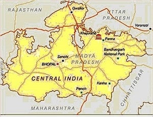 Central India has a roadways network that comprises national highways, state highways, district roads, and other types of roads. It is home to 14 national highways spanning 4676 km and various state highways with an overall span of 8728 km. It is a trendsetter in the country in terms of execution of the Union Government’s plan to extend the roadway network to the villages.
Climate
CENTRAL INDIA:
The summer season is characterized by hot days and nights whereas during the winter season the days are warm and sunny and nights are very cold. July marks the onset of monsoons, which last till September.
NORTHERN PLAINS:
The northern plains have characteristic extreme climatic conditions with the inland regions having hot nights and days during the summer season from April to mid-June. However during the winter season, from November to February, the days are warm and temperatures during nighttime can fall sub-zero levels. The onset of monsoons is from June and lasts till September.
About Central India & The Gangetic Plains
History
The Bhimbetka caves show evidence of paleolithic settlements in present-day Madhya Pradesh. Stone age tools have also been discovered at various places along the Narmada river valley. During the early Vedic period, the Vindhya mountains formed the southern boundary of the Indo-Aryan territory. The territory that now comprises the states of Madhya Pradesh and Chhattisgarh were ruled by numerous princes who entered into a subsidiary alliance with the British.
The flat and fertile terrain of Gangetic plains has facilitated the repeated rise and expansion of various empires, including the Maurya Empire, Gupta Empire, Delhi Sultanates, the Mughal Empire, and the Maratha Empire. During the Vedic eras of Indian history, this region was referred to as “Aryavarta” (Land of the Aryans).
Terrain
Central India has the Gangetic plains to the north and the Deccan Plateau in the south. It consists of two plateaus, Malwa and the Chhota Nagpur plateau, with an average elevation of 500 – 700 metres. The area straddles the Narmada River, which runs east and west between the Vindhya and Satpura ranges; these ranges and the Narmada are the traditional boundaries between the north and south of India. The highest point is Dhupgarh, with an elevation of 1,350 m.
The Gangetic plains is the world’s most extensive expanse of uninterrupted alluvium formed by the deposition of silt by the numerous rivers. The plains are one of the world’s most intensely farmed areas, and rank among the world’s most densely populated areas.
Roads
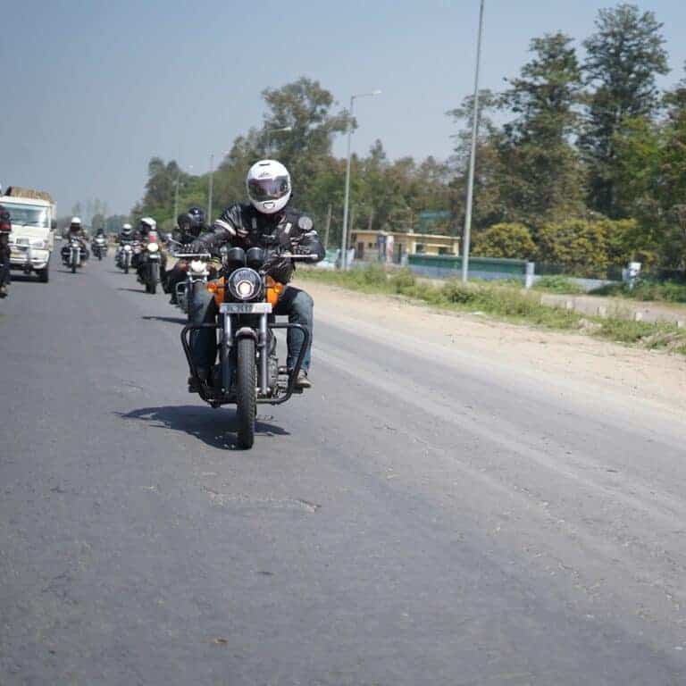
 Central India has a roadways network that comprises national highways, state highways, district roads, and other types of roads. It is home to 14 national highways spanning 4676 km and various state highways with an overall span of 8728 km. It is a trendsetter in the country in terms of execution of the Union Government’s plan to extend the roadway network to the villages.
Climate
CENTRAL INDIA:
The summer season is characterized by hot days and nights whereas during the winter season the days are warm and sunny and nights are very cold. July marks the onset of monsoons, which last till September.
NORTHERN PLAINS:
The northern plains have characteristic extreme climatic conditions with the inland regions having hot nights and days during the summer season from April to mid-June. However during the winter season, from November to February, the days are warm and temperatures during nighttime can fall sub-zero levels. The onset of monsoons is from June and lasts till September.

“Benaras is older than history, older than tradition, older even than legend and looks twice as old as all of them put together"
Mark Twain
Tour Itinerary
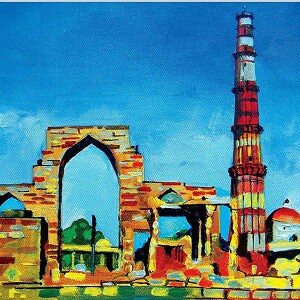
Steeped in history yet overflowing with modern life. Colourful, cacophonous Delhi pulsates with the relentless rhythms of humanity like few other cities on earth.
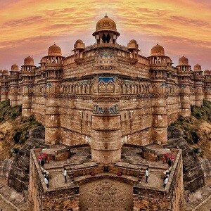
Famous for its dramatic and dominant hilltop fort, which Mughal emperor Babur reputedly described as the pearl of Indian fortresses.
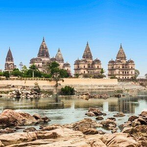
A supreme display of Mughal-influenced Rajput architecture in the shape of spectacular palaces, temples and royal chhatris (cenotaphs).
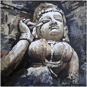
India's most titillating town is famed far and wide for the erotic stone carvings that swathe Khajuraho’s three groups of World Heritage–listed temples.
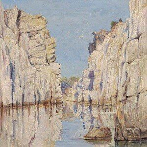
Is situated on the banks of river Narmada. Its most famous sights are the Dhuandhar Falls, Marble Rocks, and the Chaunsath Yogini temple.

If your sole reason for visiting an Indian tiger reserve is to see a tiger, look no further. India's 2014 tiger census counted 68 tigers here, the great majority of them in the relatively small (453 sq. km) territory .
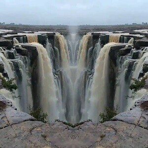
Famous for its waterfalls and Rewa Fort. Also, The Rewa Solar Power Project is one of the largest single-site solar power plants in India and the world.

Varanasi is the India of your imagination. This is one of the world's oldest continually inhabited cities, and one of the holiest in Hinduism.

Pilgrims come to the Ganges here to wash away sins in the sacred waters, to cremate their loved ones, or simply to die here, hoping for liberation from the cycle of rebirth.

Sprinkled with exceptional Islamic and British Raj–era architecture, stuffed with fascinating bazaars and famed throughout India for its food.
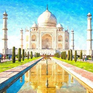
The magical allure of the Taj Mahal draws tourists to Agra like moths to a wondrous flame. And despite the hype, it’s every bit as good as you’ve heard.
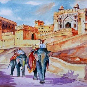
Enthralling, historical Jaipur, Rajasthan’s capital, is the gateway to India’s most flamboyant state.
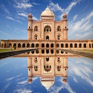
Steeped in history yet overflowing with modern life. Colourful, cacophonous Delhi pulsates with the relentless rhythms of humanity like few other cities on earth.
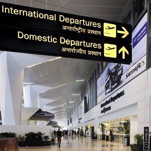
Back home safely after a fulfilling adventure.
Tour Information
- Guided tour as per itinerary.
- Experienced tour guides.
- Road maps and travel information.
- All hotel accommodation and meals.
- All transfers including Airport transfers, sightseeing spots and during the ride.
- All motorcycle hire charges for the guided tour duration.
- Fuel.
- Third party insurance for the motorcycles.
- All sightseeing spot entry tickets and guide charges (excluding camera charges).
- Road and bridge tolls.
- Skilled motorcycle mechanic.
- Support vehicle for carrying luggage, spares, medical kit and other essentials.
- Tour T-shirt and Hoodie.
- Goods and Services Tax.
- Adequate travel, medical and accidental insurance of the riders.
- Air travel and visas.
- Alcoholic and non-alcoholic beverages.
- Tips and laundry.
- Repair of damages to the motorcycle caused by the riders.
- Personal riding and safety gear.
- All telephone/mobile services.
- Anything not mentioned in the Inclusions section.
Signed copies of:
- Insurance & Medical Form
- Liability Waiver Form
Original and 2 photocopies each, of following:
- Driving License
- International Driving Permit
- Travel Insurance
- Passport
- Visa
Passport sized photographs (Four)
- Riding Jacket
- Riding Pants
- Motorcycle Boots
- Helmet : Full face (essential)
- Riding Gloves
- Kidney Belt
- Hydration Pack
- Water Resistant Backpack
- Goggles/Sunglasses
- Snood/Buff Scarf
Essentials:
- Sun Block
- Mosquito Repellent
- Hand Sanitizer
- Insulated Flask
- Lip Balm
- Sun Hat/Cap
- Personal Medication
- Basic First Aid Kit
Special Offers
We are offering limited period discounts. Contact us to find out if you are eligible.
