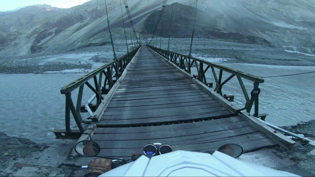
"Land of High Passes"
"Leh & Ladakh Tour"
Spectacularly jagged, arid mountains enfold this magical Buddhist ex-kingdom. Picture-perfect gompas (Tibetan Buddhist monasteries) dramatically crown rocky outcrops next to fluttering prayer flags and whitewashed stupas, while prayer wheels spun clockwise release merit-making mantras. Gompa interiors are a riot of golden Buddhas and intricately colourful murals and home to red-robed monks. It’s a little corner of Tibet marooned in the furthest reaches of India.
Tour Summary
-
13 Days, 12 Nights
-
Distance: 1900 Km
-
Riding Days: 9
-
Level: Moderate to Tough
Tour Summary
-
13 Days, 12 Nights
-
Distance: 1900 Km
-
Riding Days: 9
-
Level: Moderate to Tough
"Leh & Ladakh Tour"
Spectacularly jagged, arid mountains enfold this magical Buddhist ex-kingdom. Picture-perfect gompas (Tibetan Buddhist monasteries) dramatically crown rocky outcrops next to fluttering prayer flags and whitewashed stupas, while prayer wheels spun clockwise release merit-making mantras. Gompa interiors are a riot of golden Buddhas and intricately colourful murals and home to red-robed monks. It’s a little corner of Tibet marooned in the furthest reaches of India.
About Ladakh
History
Leh (Ladakh) was known in the past by different names. It was called Maryul or low land by some Kha- chumpa by others. Fa-Hein referred to it as Kia-Chha and Hiuen Tsang as Ma-Lo-Pho. The ancient inhabitants of Ladakh were Dards, an Indo- Aryan race. Immigrants of Tibet, Skardu, and nearby parts like Purang settled in Ladakh. In ancient times the present Leh district was a part of Greater Ladakh spread over from Kailash Mansarover to Swaat (Dardistan). In the 7th Century A.D fierce wars were fought by Tibet and China in the Baltistan area of the Greater Ladakh. Around this period, the ruler of Kashmir, Lalitaditya conquered Ladakh. In the 8th Century A.D., the Arabs conquered Kashghar and established their control over Central Asia which embraced Islam in the 9th century A.D and thus a buffer state came into being between Tibet and China, terminating the hostilities between the two warring countries. Until 2019, Ladakh was a region of the Indian-administered state of Jammu and Kashmir. In August 2019, the Parliament of India passed an act by which Ladakh became a union territory on 31 October 2019.
Terrain
Ladakh covers about 45,000 square miles (117,000 square km) and contains the Ladakh Range, which is a southeastern extension of the Karakoram Range, and the upper Indus River valley. Ladakh is the highest plateau in India with much of it being over 3,000 m (9,800 ft). It extends from the Himalayan to the Kunlun Ranges and includes the upper Indus River valley. Its natural features consist mainly of high plains and deep valleys. The high plain predominates in the east, diminishing gradually toward the west. In southeastern Ladakh lies Rupshu, an area of large, brackish lakes with a uniform elevation of about 13,500 feet (4,100 metres). To the northwest of Rupshu lies the Zanskar Range, an inaccessible region where the people and the cattle remain indoors for much of the year because of the cold. Zanskar is drained by the Zanskar River, which, flowing northward, joins the Indus River.
Roads
 There is about 1,800 km (1,100 mi) of roads in Ladakh of which 800 km (500 mi) are surfaced. The majority of roads in Ladakh are looked after by the Border Roads Organisation. The third road axis connecting Himachal Pradesh with Ladakh (Darcha-Padam-Nimu-Leh) will be tested through the current winter to provide year-round access. The earlier two routes (Srinagar-Zozila-Kargil-Leh and Manali-Bara Lachla-Leh) invariably get closed in peak winter due to heavy snowfall in the high passes. Once a tunnel at Sinkun La comes up, this road will provide connectivity to Ladakh throughout the year. This axis has obviated the possibility of building three tunnels at Baralalcha, Tanglang La, and Lachung La on the old Manali-Leh Road (see map)
Climate
The climate of Ladakh is cold and dry. Average annual precipitation is roughly 3 inches (80 mm); fine, dry, flaked snow is frequent and sometimes falls heavily. The regions on the north flank of the Himalayas – Dras, the Suru valley and Zangskar – experience heavy snowfall and remain cut off from the rest of the region for several months in the year, as the whole region remains cut off by road from the rest of the country. Summers are short, though they are long enough to grow crops. The summer weather is dry and pleasant. Temperature ranges are from 3 to 35 °C (37 to 95 °F) in summer and minimums range from −20 to −35 °C (−4 to −31 °F) in winter.
About Ladakh

History
Leh (Ladakh) was known in the past by different names. It was called Maryul or low land by some Kha- chumpa by others. Fa-Hein referred to it as Kia-Chha and Hiuen Tsang as Ma-Lo-Pho. The ancient inhabitants of Ladakh were Dards, an Indo- Aryan race. Immigrants of Tibet, Skardu, and nearby parts like Purang settled in Ladakh. In ancient times the present Leh district was a part of Greater Ladakh spread over from Kailash Mansarover to Swaat (Dardistan). In the 7th Century A.D fierce wars were fought by Tibet and China in the Baltistan area of the Greater Ladakh. Around this period, the ruler of Kashmir, Lalitaditya conquered Ladakh. In the 8th Century A.D., the Arabs conquered Kashghar and established their control over Central Asia which embraced Islam in the 9th century A.D and thus a buffer state came into being between Tibet and China, terminating the hostilities between the two warring countries. Until 2019, Ladakh was a region of the Indian-administered state of Jammu and Kashmir. In August 2019, the Parliament of India passed an act by which Ladakh became a union territory on 31 October 2019.
Terrain
Ladakh covers about 45,000 square miles (117,000 square km) and contains the Ladakh Range, which is a southeastern extension of the Karakoram Range, and the upper Indus River valley. Ladakh is the highest plateau in India with much of it being over 3,000 m (9,800 ft). It extends from the Himalayan to the Kunlun Ranges and includes the upper Indus River valley. Its natural features consist mainly of high plains and deep valleys. The high plain predominates in the east, diminishing gradually toward the west. In southeastern Ladakh lies Rupshu, an area of large, brackish lakes with a uniform elevation of about 13,500 feet (4,100 metres). To the northwest of Rupshu lies the Zanskar Range, an inaccessible region where the people and the cattle remain indoors for much of the year because of the cold. Zanskar is drained by the Zanskar River, which, flowing northward, joins the Indus River.


Roads
 There are about 1,800 km (1,100 mi) of roads in Ladakh of which 800 km (500 mi) are surfaced. The majority of roads in Ladakh are looked after by the Border Roads Organisation. The third road axis connecting Himachal Pradesh with Ladakh (Darcha-Padam-Nimu-Leh) will be tested through the current winter to provide year-round access. The earlier two routes (Srinagar-Zozila-Kargil-Leh and Manali-Bara Lachla-Leh) invariably get closed in peak winter due to heavy snowfall in the high passes. Once a tunnel at Sinkun La comes up, this road will provide connectivity to Ladakh throughout the year. This axis has obviated the possibility of building three tunnels at Baralalcha, Tanglang La, and Lachung La on the old Manali-Leh Road (see map)
Climate
The climate of Ladakh is cold and dry. Average annual precipitation is roughly 3 inches (80 mm); fine, dry, flaked snow is frequent and sometimes falls heavily. The regions on the north flank of the Himalayas – Dras, the Suru valley and Zangskar – experience heavy snowfall and remain cut off from the rest of the region for several months in the year, as the whole region remains cut off by road from the rest of the country. Summers are short, though they are long enough to grow crops. The summer weather is dry and pleasant. Temperature ranges are from 3 to 35 °C (37 to 95 °F) in summer and minimums range from −20 to −35 °C (−4 to −31 °F) in winter.

“He who climbs upon the highest mountains laughs at all tragedies, real or imaginary.”
Friedrich Nietzsche
Tour Itinerary

Delhi pulsates with the relentless rhythms of humanity like few other cities on earth. Take a connecting flight to Palampur to embark on your adventure.

A hill station known for the breathtaking natural beauty of its surroundings as also skiing, trekking, and natural springs.

Srinagar is the summer capital of the Indian union territory of Jammu and Kashmir. It lies in the Kashmir Valley on the banks of the Jhelum River, and Dal and Anchar lakes.

Kargil is the second largest town in Ladakh. The town is situated on the confluence of River Suru and Nallah Wakha at an altitude of 2704 m.

Nestled in the majestic Himalayas, Leh is a picturesque travel destination. The rugged mountains and the colorful cultural life add a unique charm to this region.

Due to the strong influence of Tibetan Buddhism, Leh is also known as Little Tibet. Barren mountains with brightly painted gompas add to the overall charm.
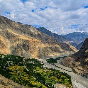
One of the northernmost villages in the country, Turtuk is situated in the Leh district of the Nubra Valley. It is one of the gateways to the Siachen Glacier.

Hemis is known for the Hemis monastery that was established in 1672 AD. The village is close to the Hemis National Park, home to the endangered snow leopard.
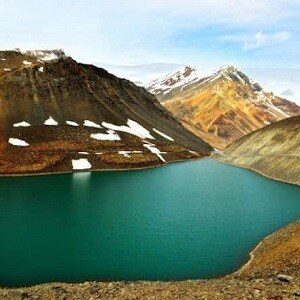
Located at an altitude of 10,890 feet, this quaint halt on the Leh-Manali highway has the Bhaga river running alongside the town.
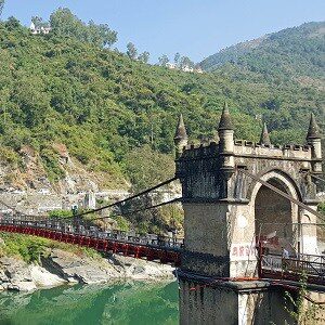
Panoramic Mandi is spread out along the river Beas. The historically significant and spiritually eminent town is also known as 'Varanasi of the Hills' or 'Choti Kashi'.

Palampur is a hill station in India’s northern state of Himachal Pradesh, known for tea gardens and views of the snow-capped Dhauladhar mountain range.
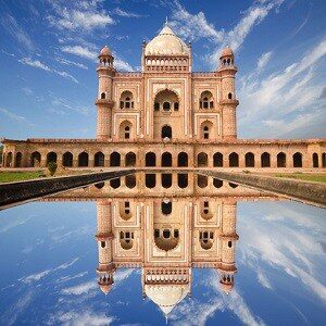
Steeped in history yet overflowing with modern life. Colourful, cacophonous Delhi pulsates with the relentless rhythms of humanity like few other cities on earth.
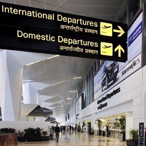
Back home safely after a fulfilling adventure.
Tour Information
- Guided tour as per itinerary.
- Experienced tour guides.
- Road maps and travel information.
- All hotel accommodation and meals.
- All transfers including Airport transfers, sightseeing spots and during the ride.
- All motorcycle hire charges for the guided tour duration.
- Fuel.
- Third party insurance for the motorcycles.
- All sightseeing spot entry tickets and guide charges (excluding camera charges).
- Road and bridge tolls.
- Skilled motorcycle mechanic.
- Support vehicle for carrying luggage, spares, medical kit and other essentials (for groups of six or more riders).
- Tour T-shirt and Hoodie.
- Goods and Services Tax.
- Adequate travel, medical and accidental insurance of the riders.
- Air travel and visas.
- Alcoholic and non-alcoholic beverages.
- Tips and laundry.
- Repair of damages to the motorcycle caused by the riders.
- Personal riding and safety gear.
- All telephone/mobile services.
- Anything not mentioned in the Inclusions section.
Signed copies of:
- Insurance & Medical Form
- Liability Waiver Form
Original and 2 photocopies each, of following:
- Driving License
- International Driving Permit
- Travel Insurance
- Passport
- Visa
Passport sized photographs (Four)
- Riding Jacket
- Riding Pants
- Motorcycle Boots
- Helmet : Full face (essential)
- Riding Gloves
- Kidney Belt
- Hydration Pack
- Water Resistant Backpack
- Goggles/Sunglasses
- Snood/Buff Scarf
Essentials:
- Sun Block
- Mosquito Repellent
- Hand Sanitizer
- Insulated Flask
- Lip Balm
- Sun Hat/Cap
- Personal Medication
- Basic First Aid Kit
Special Offers
We are offering limited period discounts. Contact us to find out if you are eligible.


